remote desktop report
A detailed, evidence‑led assessment of your land — with the option of a 1‑hour consultation before or after the report is produced.
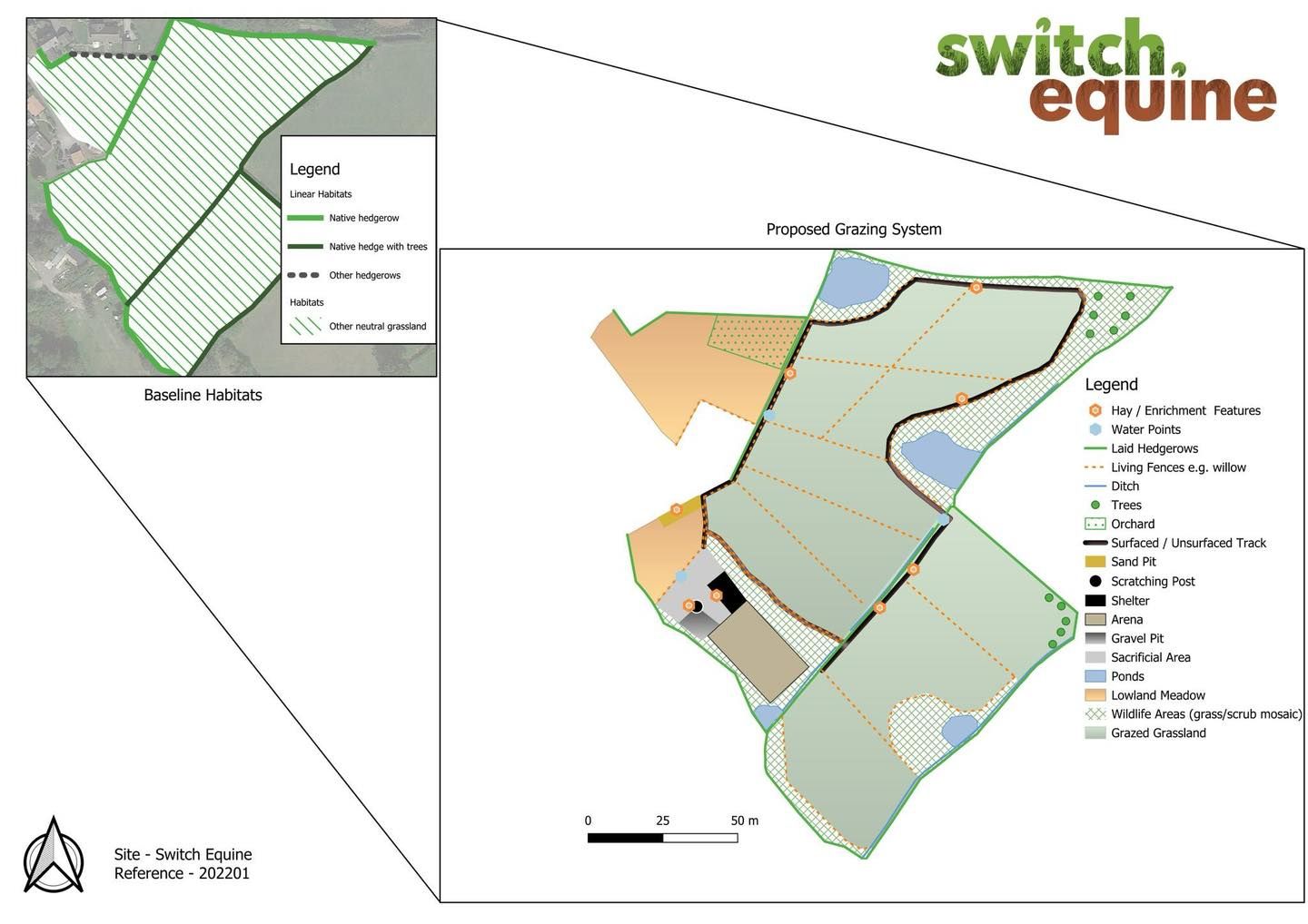
Our Remote Desktop Report combines advanced GIS analysis with high‑quality environmental datasets to build a clear, accurate picture of your land and the ecological processes shaping it. This goes far beyond traditional equestrian layout design. By analysing topography, soils, water movement, habitats, and historical land use, we can understand how your land functions as a living system — and how to design for resilience, horse welfare, and long‑term productivity.
You can choose to add a 1‑hour online consultation, either before the report (to shape the brief and explore your goals) or after the report (to walk through the findings and discuss next steps). Many clients find the combination especially helpful.
